


Data Management, Decision Support Systems and Flood Forecasting
An effective data collection programme must be supported by means for the end user to access the data. This could be via a GIS platform for further analysis, or integrated within an online data display, decision support system or flood forecasting system. Wight Water’s engineers have extensive experience developing on and off-line data management systems. We can work with any public domain GIS platform, and can readily integrate static or live data feeds within other systems. Some of the more commonly used platforms we use are listed below.
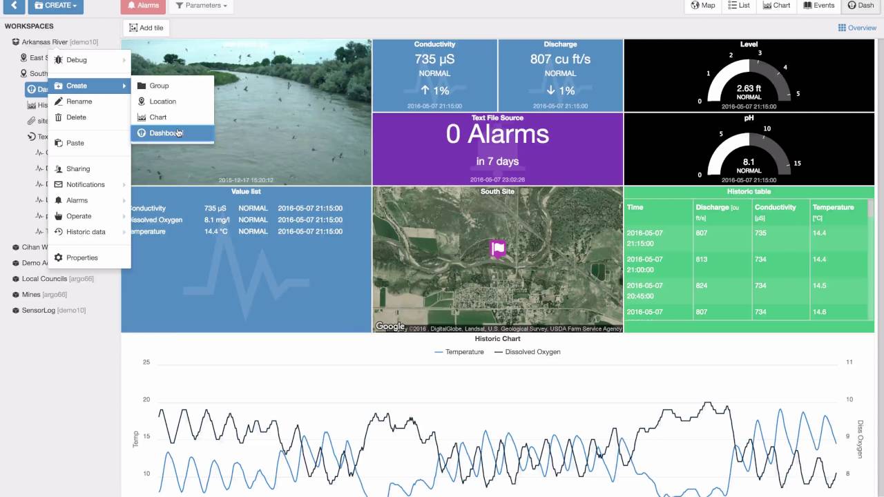
Eagle.io
Eagle.io is a web based data collection and presentation system that communicates directly with remote sites to extract data. Eagle.io has customisable dashboards and is designed for access by untrained personnel.
Visit https://eagle.io/ for more information.
Visit https://eagle.io/ for more information.
Delft-FEWS
Developed by Deltares, Delft-FEWS is one of the most widely used flood forecasting platforms in the world. Delft-FEWS is used by the Australian Bureau of Meteorology for their national flood forecasting operations (HyFS).
Visit https://www.deltares.nl/en/software/flood-forecasting-system-delft-fews-2/
for more information.
FloodIntel
Developed by BMT Eastern Australia, FloodIntel is a highly intuitive online flood intelligence system. It has been developed for, and in close consultation with, emergency responders, floodplain managers, engineers, and land use planners. The result is a fast, accurate and practical tool to support better, more timely decisions. FloodIntel’s customisable and interactive web interface revolutionises the way users receive, analyse and interpret flood information for past, current, near future and what-if scenarios.
Visit http://www.floodintel.com.au/
for more information