
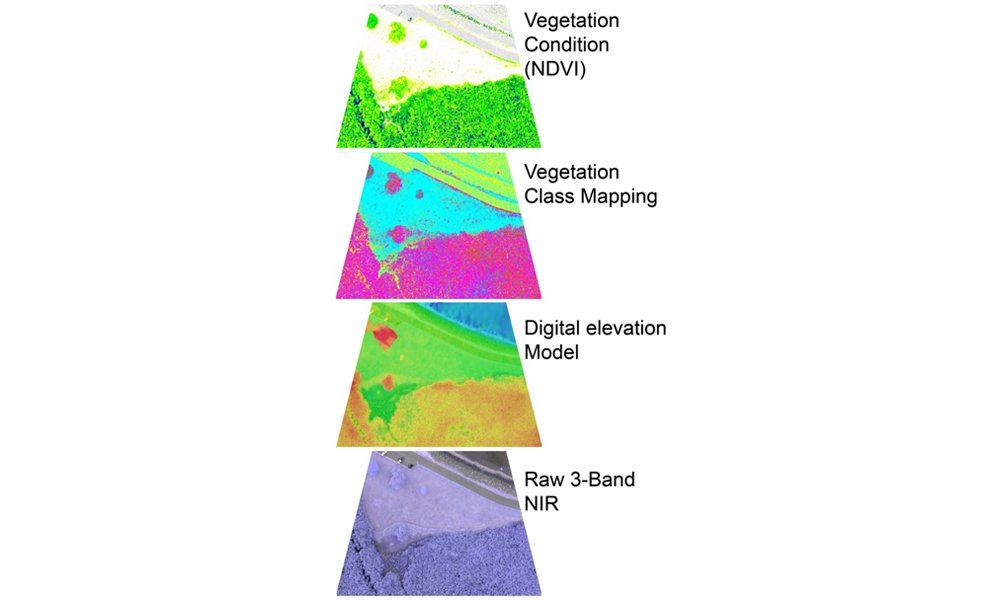
Near infrared imagery
Using our near-infrared camera, we can provide orthorectified and georeferenced aerial photos in the red, green and near infrared (NIR) bands. The NIR imagery can be used for vegetation mapping (vegetation class and condition). Vegetation condition is assessed using the normalized difference vegetation index (NDVI). The NDVI is useful to identify water stress, dieback areas, healthy areas and areas under recovery. We are also able to measure and map vegetation height.